|
||
|
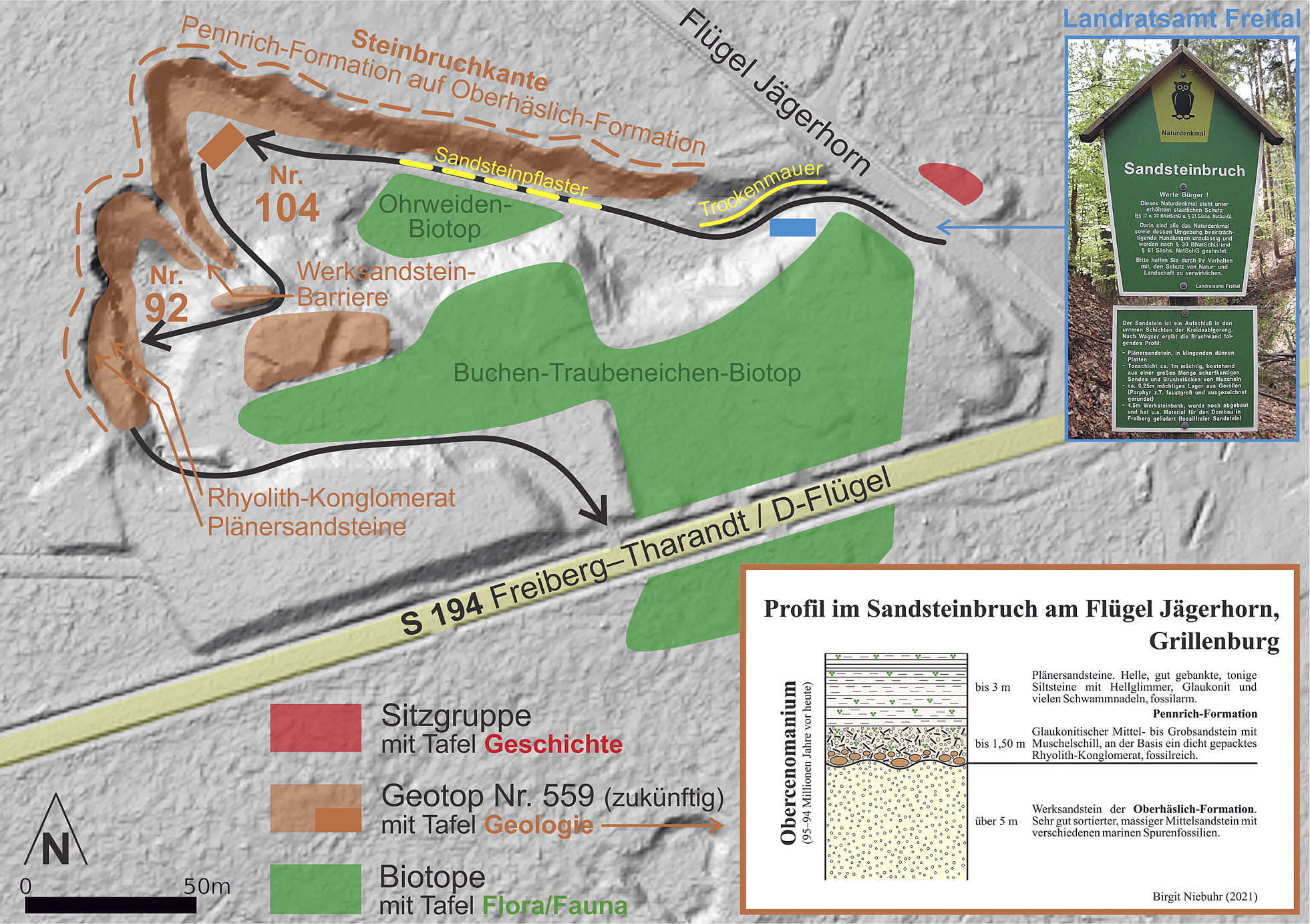
Digitales Geländemodell (DGM; GeoSN 2021) des ehemaligen und heutigen Grillenburger Sandsteinbruchs am Flügel Jägerhorn (Geotop Nr. 559). Zur bisherigen Verbreitung der Flächennaturdenkmale WRK 032 und 033 siehe Umweltportal Sachsen (2020). Figure 15. Digital elevation model (DEM; GeoSN 2021) of the former and recent Grillenburg sandstone quarry at the Flügel Jägerhorn (geotope no. 559). For areal distribution of the previous area national monuments WRK 032 and 033, see Umweltportal Sachsen (2020). |